We offer over 30 courses in geographic information systems, remote sensing, geospatial programming, spatial data science, and geospatial intelligence. Classes are scheduled in five 10-week terms each year: two in the fall, two in the spring, and one every summer.

Explore the geographies of cyberspace, the geopolitics of cyberwar, and techniques that might be employed in such conflicts. This class explores ideas on governance and network architecture, the politics of censorship and hacking, and the politics of grassroots activism enabled by the internet.
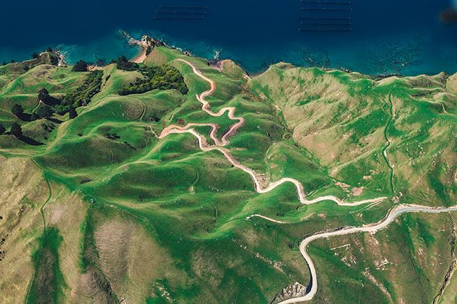
Focus on the use of remotely sensed imagery and elevation data in GIS applications. Appropriate for those who are already working in the geospatial profession and wish to use imagery and elevation data in visualization and spatial analysis.
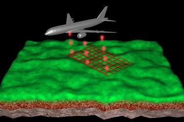
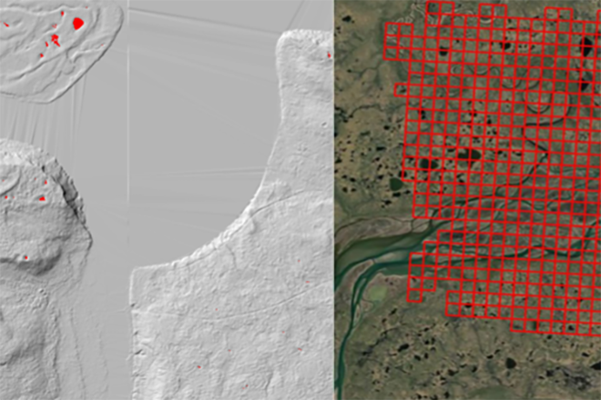
Work with lidar systems' design, operation, data processing techniques, and product generation to address typical application scenarios faced by the geospatial professional.
Explore meaningful applications of GIS, learn basic GIS mapping principles and how to tell stories with maps. Study geospatial concepts, methods, and techniques at an introductory level, including GPS positioning, spatial modeling, and geo app development.
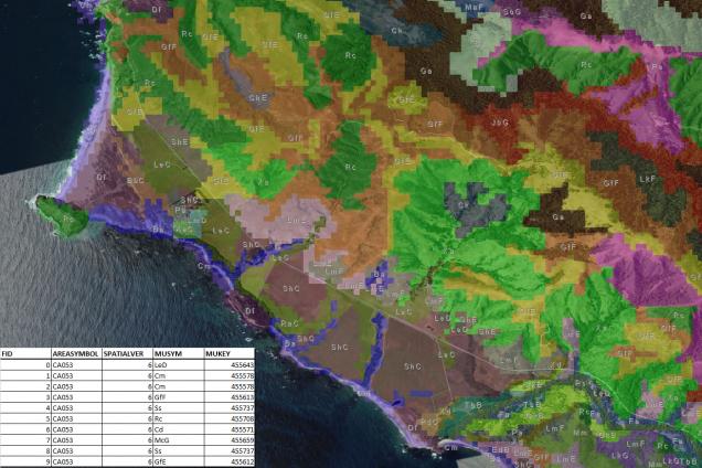
Employ real-world scenarios to discover GIS concepts and tools such as vector and raster analysis, attribute and spatial queries, joins and links, buffers, address geocoding, cartographic design, thematic mapping, surface interpolation, and much more.
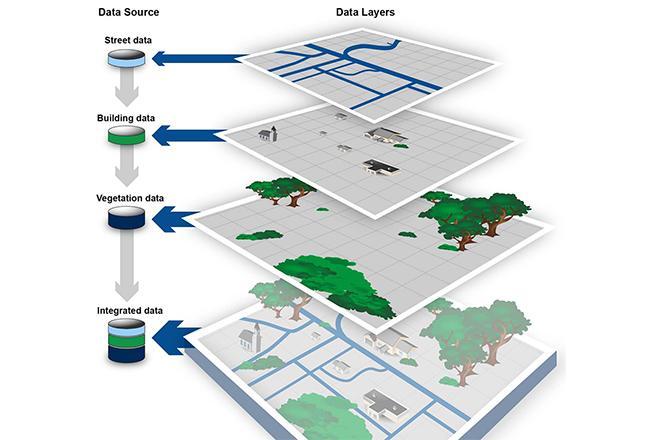
Complete software-based projects and discuss concepts relating to how GIS software can be used to integrate geographic data compiled from various sources. Perform tasks involved in creating a digital geographic database.

Learn ModelBuilder and Python scripting skills to make repetitive geoprocessing tasks easier, faster and automatic.
Learn cartographic design principles and thematic mapmaking techniques. Engage in the cartographic design process through selecting visual variables, classifying and generalizing data, applying principles of color and contrast, and choosing map projections based on map audience and purpose.
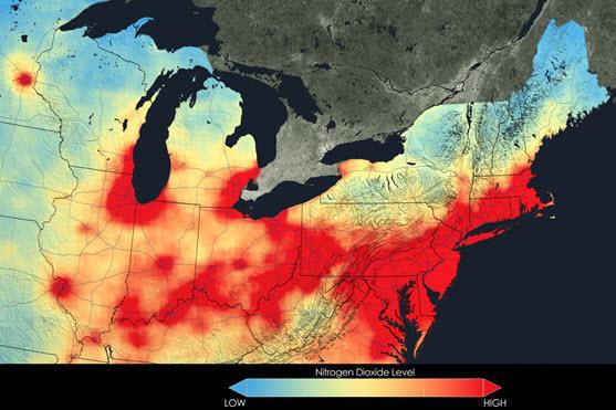
Explore topics like volatile climate and weather, vulnerable drinking water supplies, and shrinking wildlife habitats and learn about data and spatial analysis techniques commonly employed in environmental applications.
Learn advanced applications of Python for developing and customizing GIS software, designing user interfaces, solving complex geoprocessing tasks, and leveraging open source technology.

Experience supervised non-group instruction including individual field experience, practicums, or internships.

Earn credit through contributions to the Department's resident programs. Qualified MGIS students will be encouraged to earn one credit for every semester that they supervise a resident Penn State Geography student in a GIS-related internship conducted in the MGIS student's place of work.

Engage in the culminating experience in the MS in Spatial Data Science (SDS). Candidates in the SDS graduate program who choose to do a scholarly paper must design, implement, and report on a project based on the application of spatial data science knowledge and skillsets gained through the SDS curriculum.
Explore the relationships between culture and civil security and the process of geographically analyzing social, political, economic, and demographic information to understand human history, institutions, and behaviors.

Explore the emerging science of analytical reasoning mediated through human-centered interactive geographic visualization and computational methods. Examine the state-of-art in geovisual analytics science.

Trace the roots of Spatial Data Science Ethics in moral philosophy, professional ethics frameworks, and critical studies in the geospatial and data science fields. Strengthen moral reasoning skills through rigorous analyses of ethical case studies.
Survey the process of GIS design through critical reading, writing and collaborative discussion. Discover the broad range of current GIS systems, how they are designed and evaluated, and how emerging technologies may impact their design and implementation in the near future.

Learn about FOSS vs. proprietary GIS software, open data and standards for web mapping, and how to create beautiful and interactive web maps with Javascript and Leaflet.
Discover what makes spatial data special and why spatial analysis reveals a truth about spatial data. Learn about the choice and application of appropriate methods for the analysis of the spatial data often encountered in applied geography.
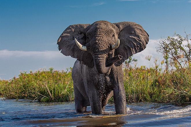
Use a problem-based approach for thinking about conservation challenges, and for choosing the specific geospatial tools and datasets for solving those problems that will inform students' future conservation work.

Focus on theoretical discussions in spatial data science, as well as on applying a range of spatial data science skills and tools to solve real-world problems and model geographic phenomena.
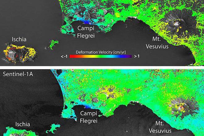
Encounter emerging tools, techniques, and sensors in the remote sensing industry, engaging with the scientific literature, guest lecturers, and hands-on activities that focus on the state-of-the-art in remote sensing and image analysis.

Explore the process and application of statistical and spatial methods used to map, model and analyze health and disease. Learn appropriate methods for the analysis of health and disease often encountered in applied geography.

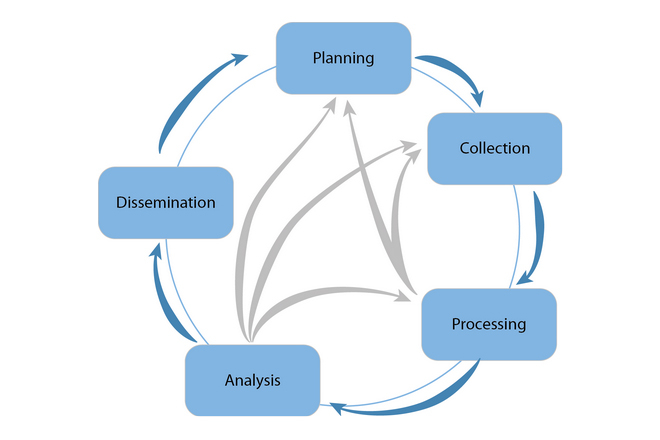
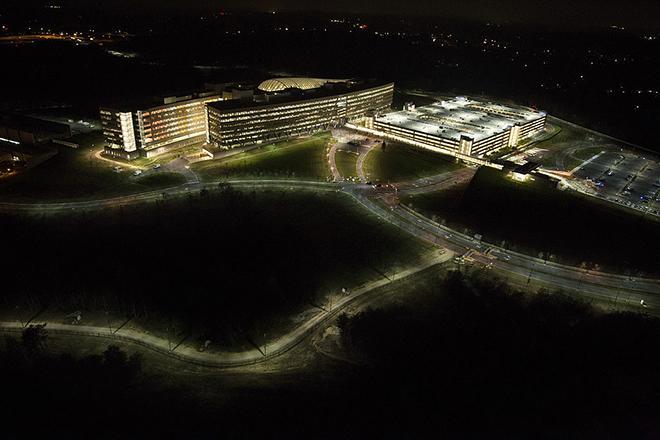
Enhance your understanding of the role of geospatial intelligence, develop individual competencies, reinforce professional concepts, and improve your analytical techniques and methods.

Build upon your past coursework to identify and investigate a real-world problem using a GIS or remote sensing tool. Evaluate and apply analytical methods and recognize ethical and professional issues in the spatial domain.

Develop the proposal for your capstone project with mentorship from a faculty advisor.

Finalize your capstone project with mentorship from a faculty advisor.

Engage in creative projects, including non-thesis research, which are supervised on an individual basis and are beyond the scope of formal courses.

Work with individual direction from a faculty member on a topic of mutual interest in geospatial intelligence.

Study a topical or special interest subject. These courses may be offered infrequently; several different topics may be taught in one year or term. Visit the course page for specifics on current offerings.

Study abroad and focus on data analytics and professional practice in Geographic Information Systems with other international graduate students. Address a global-scale geospatial analysis problem, present your work, and develop new connections with European Union geospatial professionals.

Engage in a culminating experience in the MS in Spatial Data Science (SDS). Candidates in the SDS graduate program who choose to do a thesis must write and defend, at an oral examination, a thesis based upon original research in the field of spatial data science.
Engage in a culminating experience in the MS in Spatial Data Science (SDS). Candidates in the SDS graduate program who choose to do a thesis must write and defend, at an oral examination, a thesis based upon original research in the field of spatial data science.
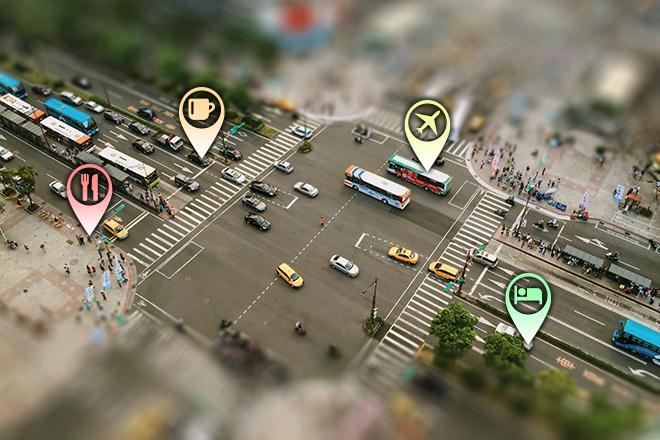
Extend the application of geospatial intelligence analytical methods to the business world for competitive advantage. Apply location technologies, geospatial analysis, and business geography (demographics and psychographics) to support competitive business decision-making.

Investigate the ways in which geographic perspectives and technologies play a major role in planning for and responding to emergencies. Enhance your understanding of rapidly-changing geospatial technologies as they relate to the also rapidly-changing field of emergency management.
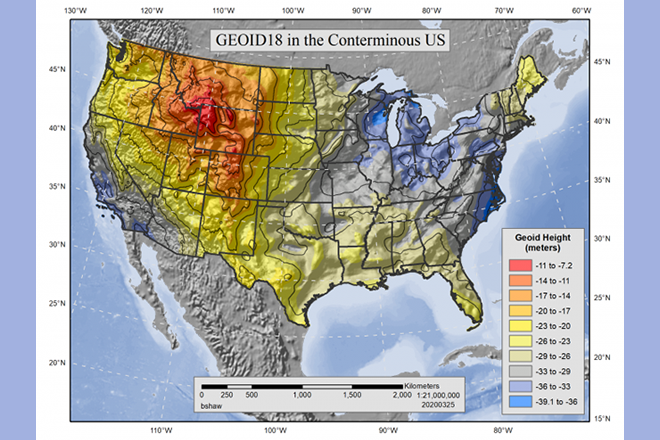
Delve into the world of map projections, knowledge which is essential for GIS professionals. Investigate the merging of multiple datasets and become familiar with the development of grid systems, the underlying distortion from map projections, and how measurement accuracy can be assessed.
Learn to build web apps. Investigate the fundamentals of web programming, work with JavaScript and a mapping application programming interface (API) developed by Esri. Create visualizations of your own data and learn how to develop an interface to enable users to interact with your map.

Gain an understanding of how the various pieces of cloud and server GIS architecture fit together. Investigate Esri's and others' offerings in the space, learn to implement ArcGIS Enterprise on Amazon EC2, make online maps with Carto and Mapbox, and engage in some blue sky thinking of your own.
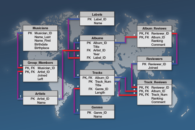
Delve into Relational Database Management Systems (RDBMS) and Geographic Information Systems (GIS) as you learn to create, maintain, and query spatial databases in desktop and enterprise environments.
Students choosing this culminating project option will synthesize the learning they have completed in their previous MGIS coursework and develop an applied spatial analysis project that utilizes contemporary methods, technologies, and data sources to solve a problem in their field.

Investigate geospatial project management, which encompasses technical methods such as system design and analysis and interpersonal factors that affect professional relationships. Devise a project plan from a scenario that is based upon a real-life geodatabase.
Think critically, consider alternative viewpoints, and question your own assumptions when analyzing why human events occur over place and time. Investigate products that support decision-making in national and homeland security, law enforcement, emergency management, and relief efforts.
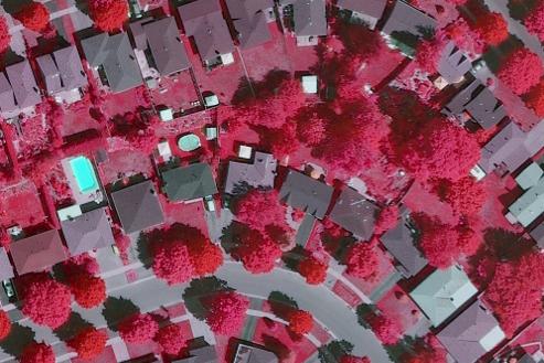
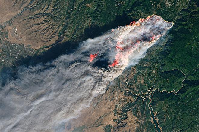
Make sense of complex and exciting datasets gathered from satellite and aerial systems. Explore the tools, methods, and techniques used to extract actionable and meaningful information from these data.
Cultivate knowledge of the capabilities and limitations of geographic information systems (GIS) and the skills needed to realize their potential in the context of the geospatial intelligence tradecraft.
Explore the challenges and opportunities that arise from the fusion of human spatial analysis with computational techniques. Learn about human-machine collaboration using geospatial artificial intelligence (GeoAI) in Geospatial Intelligence and about related ethical and professional considerations.

Focus on the geospatial utilization of Unmanned Aerial Systems (UAS) and cultivate your knowledge of the capabilities and limitations of UAS and data post-processing systems. Explore fundamental concepts surrounding the operation of UAS in the United States.
Our online courses can be taken individually for professional development. For many students, starting with one course is a great way to try online learning with Penn State before committing to a certificate or degree program. This option allows for learning more about a specific topic or expanding a particular skill set.
We suggest that you register at least two weeks before your class starts. Check out the course schedule for start dates.